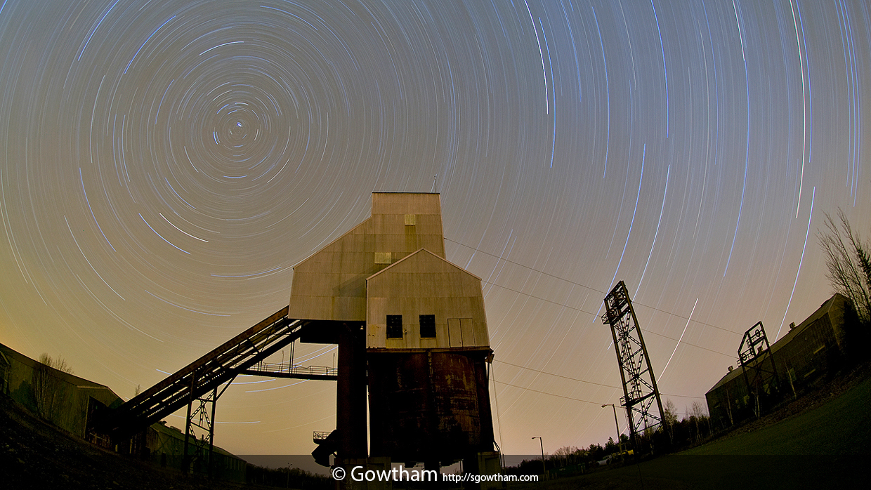
Why do stars appear to move in circles?
Simple reason is Earth’s Rotation. To elaborate a bit more, the line that connects South and North Poles of our Earth (the axis of Earth’s rotation) points very closely at Polaris – the star the currently holds the title of North Star (or Pole Star). The North Star has been historically used by explorers to determine their latitude. The angle the North Star makes with respect to the horizon is equal to the latitude of the observer. The North Star is only visible in northern hemisphere skies and as such is useless for determining latitude in the southern hemisphere. Due to the precession of the equinoxes the direction of the Earth’s axis is very slowly but constantly changing, and as the projection of the Earth’s axis moves around the celestial sphere over the millennia, the role of North Star passes from one star to another. Since the precession of the equinoxes is so slow, a single star typically holds that title for many centuries.
Although it’s our Earth that is rotating about its axis, from an observer’s point of view (who is on Earth, like the camera mounted on a tripod pointing at the sky) the Earth appears to be stationary and the sky (or the stars above) appear to be rotating. Since the axis of Earth’s rotation nearly passes through the Pole Star, that too appears almost stationary (bright dot at the center in the above picture) while rest of the stars appear to go in concentric circles around the Pole Star.
Centennial Mine
It is/was an underground copper mine consisting of 7 incline shafts. In 1876, the Centennial Mining Co. came about on the previously owned Schoolcraft Mining Co. property and worked the Osceola Amygdaloid until 1896, at which time the company was re-organized as the Centennial Copper Co.. In 1923, Calumet and Hecla Mining Co. merged with the Ahmeek, Allouez, and Centennial Mining [closed in 1931] Cos. The combined entity was renamed the Calumet and Hecla Consolidated Copper Co. and the merged company essentially controlled all operating copper mines north of Hancock, MI. In 1944, shaft #2 was re-opened and operated until 1966 when the mine closed for good.
EXIF and other information
| Archive ID | n2c_106-2248 |
| Date and Time | 2009-11-11 00:50:58 |
| GPS Date and Time | Image does not include relevant information |
| GPS Location | 47.26353 N, -88.42915 E, 1195 ft (Goolgle Map: Pin | Directions) |
| Camera | Nikon D200 |
| Lens | AF DX Fisheye-Nikkor 10.5mm f/2.8G ED |
| Focal Length | 10.5 mm (35 mm equivalent: 15.0 mm) |
| Mode | Manual |
| Shutter Speed | 6553.5 second(s) |
| Aperture | f/4.0 |
| ISO | 100 |
| Exposure Bias | 0 |
| Flash | No |
| Filters | None |
| Light Value | -8.7 |
| Hyperfocal Distance | 1.31 m |
| Focus Distance | 1.33 m |
| Depth of Field | inf (0.66 m - inf) |
| Field of View | 99.9 deg (3.18 m) |
| Tripod | Yes |
| Notes/Remarks | White Balance set to Tungsten in Adobe Photoshop CS3 [Dave Clark] |

